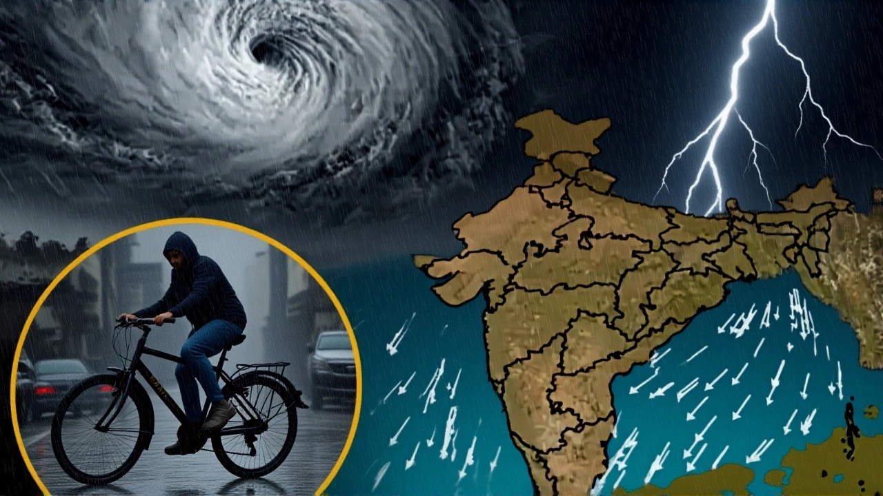
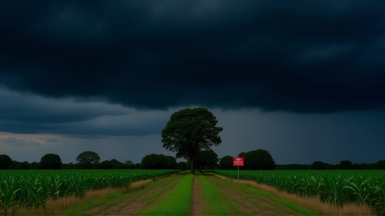
When Cyclone Montha made landfall between Machilipatnam and Kalingapatnam near Kakinada on the evening of October 28, 2025, it didn’t just bring rain—it brought chaos, courage, and a race against time. With sustained winds of 90–100 kmph gusting to 110 kmph and a storm surge pushing water one metre above normal tide levels, the cyclone carved a brutal path across Andhra Pradesh, flooding low-lying villages, uprooting trees, and leaving tens of thousands without power. The India Meteorological Department (IMD) had warned of this for days, but nothing prepares you for the sound of wind howling through tin roofs like a freight train. Here’s the thing: this wasn’t just another storm. It was the most intense system to hit this stretch of coast since 2020’s Cyclone Gati—and it came with a name that feels almost cruel in its irony. Montha, meaning "fragrant flower" in Thai, was submitted by Thailand as part of a regional naming pool. Now, it’s etched into the memory of a region fighting for survival.
Evacuations in Motion: A State on High Alert
N. Chandrababu Naidu, the Chief Minister of Andhra Pradesh, didn’t wait for the storm to arrive. By 10 a.m. on October 28, he’d ordered district collectors and police superintendents to shift residents of vulnerable coastal zones into 347 designated shelters. Schools in Visakhapatnam, Anakapalle, and West Godavari were closed. By noon, over 120,000 people had been moved—many in pickup trucks, others on foot, carrying little more than their children and a few bags. "We didn’t want to be the state that lost lives because we hesitated," Naidu told reporters, his voice tight with urgency.Across the coast, 11 National Disaster Response Force (NDRF) teams and 12 State Disaster Response Force (SDRF) units were deployed. Boats with swimmers, life jackets, and emergency medical kits were stationed at every high-risk point—from Nellore to Srikakulam. The 108/104 ambulance network was fully activated. Mobile medical camps, stocked with antibiotics, IV fluids, and mosquito repellents, were set up inside shelters. "We’re preparing for waterborne diseases, injuries from debris, and panic," said Dr. Priya Mehta, an emergency physician stationed in Kakinada.
Rainfall Domino Effect: From Andhra to the Northeast
The storm’s reach stretched far beyond the coastline. The IMD predicted isolated extremely heavy rainfall—over 200 mm in 24 hours—in Coastal Andhra Pradesh from October 27 to 29. Odisha braced for similar deluges on the 28th and 29th, with districts like Ganjam and Rayagada on orange alert. Chhattisgarh’s southern belt, already waterlogged from earlier rains, faced flash floods. Even Maharashtra’s Vidarbha region, hundreds of kilometers inland, got drenched between October 28 and 30.
And then there was the sea. Waves between 2 and 4.7 metres slammed into the Andhra coast. Fishing boats, once bobbing in the surf, were now tied down at Marina Beach in Chennai. Fishermen, many of whom live day-to-day on catch sales, watched helplessly. "We lost our nets in 2022," said Ramesh Kumar, 52, a third-generation fisherman from Nagapattinam. "We lost our house in 2020. If we lose our boat this time… what’s left?"
Science Behind the Storm: Why Montha Intensified So Fast
What made Cyclone Montha so dangerous wasn’t just its speed—it was its structure. The IMD noted "large-scale convection over the south and central Bay of Bengal," meaning a massive release of latent heat in the upper atmosphere was feeding the storm like a furnace. Independent meteorologist Ashwary Tiwari, who tracks systems on X (formerly Twitter) under @IndiaMetSky, confirmed the prediction: "It’s a low-grade cyclone now, but the wind field shows it’s organizing fast. By landfall, it’s severe. No doubt."
The storm’s northwest track, turning slightly north-northwest after landfall, was typical for this time of year—but the moisture content was unusually high. Sea surface temperatures in the Bay of Bengal had been 1–2°C above average since September, creating a perfect breeding ground. "This isn’t climate change in the abstract," said Dr. Arjun Rao, a climatologist at the Indian Institute of Tropical Meteorology. "It’s the math. Warmer water = more evaporation = more fuel for storms. We’re seeing this pattern more often now. 2018. 2020. 2023. Now 2025. It’s not a coincidence. It’s a trend."
What Happens Next? The Long Road After the Winds Die Down
As Cyclone Montha weakens over land, its remnants will push into the Northeast, bringing heavy rain and thunderstorms from October 30 to November 1. That means Assam, Meghalaya, and Tripura could face landslides and road blockages. The Indian Army has been placed on high alert, with helicopters on standby for rescue operations. Meanwhile, the National Disaster Management Authority is coordinating with state governments to pre-position food, clean water, and tents.
Recovery won’t be quick. In 2020, after Cyclone Amphan, it took Andhra Pradesh 11 months to fully restore power lines in the worst-hit districts. This time, officials say they’re aiming for 72-hour restoration of critical infrastructure—but with over 80% of the grid in coastal zones damaged, that’s optimistic. The real test? Mental health. Trauma counselors are being rushed into shelters. Children are being pulled from schools for psychological first aid.
Background: Why Cyclone Names Matter
The name Montha didn’t come from a random list. It was submitted by Thailand as part of a 13-nation rotating system managed by the World Meteorological Organization. Each country contributes 13 names, creating a pool of 169. Names are used in sequence, then recycled every few years—unless a storm is particularly deadly, in which case it’s retired. (Think: Katrina, Haiyan, or in India’s case, Phailin.) The system ensures no two storms in the same season share a name, and it helps with public awareness. "People remember names better than numbers," said IMD spokesperson Dr. Lata Gupta. "When you hear ‘Cyclone Montha,’ you know it’s personal. It’s not just a weather system. It’s a threat with a face."
Frequently Asked Questions
How many people were evacuated before Cyclone Montha made landfall?
Over 120,000 people were relocated from vulnerable coastal areas in Andhra Pradesh and Yanam before landfall, according to state disaster management reports. Evacuation centers in Visakhapatnam, Kakinada, and Srikakulam were filled to capacity, with additional shelters opened in nearby towns. The effort was one of the largest pre-emptive evacuations in the state’s recent history.
Which districts in Odisha are under the highest risk from Cyclone Montha?
Odisha’s Ganjam, Gajapati, Rayagada, Koraput, and Malkangiri districts were placed on orange alert due to expected rainfall exceeding 150 mm in 24 hours. These areas, already prone to landslides and river overflow, saw emergency teams pre-deployed. The IMD warned that runoff from Andhra’s heavy rains could cause secondary flooding in these regions even after the cyclone moved inland.
Why was the storm surge particularly dangerous for coastal Andhra Pradesh?
The storm surge of one metre above astronomical tide levels coincided with high tide in the Kakinada region, amplifying flooding in low-lying areas like Kothapeta and Narsipatnam. Many homes there are built on stilts or earthen platforms, which offered little protection. Satellite imagery showed over 47 square kilometers of coastal land submerged, including rice paddies and aquaculture ponds vital to local livelihoods.
What role did the Indian Army play during Cyclone Montha?
The Indian Army activated its Rapid Response Teams, deploying engineers to clear blocked roads, medical teams to set up field hospitals, and helicopters to airlift stranded residents from isolated villages. Helicopters from the Eastern Command flew over 87 sorties between October 28 and 29, rescuing 312 people. The Army also coordinated with the NDRF to deliver emergency rations to 23 villages cut off by floodwaters.
How does Cyclone Montha compare to previous cyclones in the Bay of Bengal?
Cyclone Montha was less intense than 2023’s Cyclone Biparjoy (150 kmph) but more damaging than 2022’s Cyclone Sitrang due to its slower movement and higher rainfall. It ranks as the 7th strongest cyclone to hit Andhra’s coast since 2010. What’s alarming is its frequency: six major cyclones have struck this region in the last 15 years, compared to just two in the previous 15. Climate models suggest this trend will continue.
What’s the long-term impact on agriculture in coastal Andhra Pradesh?
Over 180,000 hectares of standing crops—mainly paddy, sugarcane, and chilli—were destroyed. Saltwater intrusion has contaminated 45% of farmland in the Krishna and Godavari deltas, making it unusable for at least one growing season. The state government has announced compensation of ₹15,000 per hectare, but farmers say it won’t cover seed, fertilizer, or labor costs. Recovery will require soil treatment and new irrigation systems, which could take years.